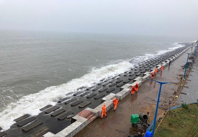
New Delhi: Ahead of the possible formation of a cyclone over the central Bay of Bengal on March 21, Union Home Secretary on Thursday reviewed the preparedness of central ministries and agencies and the administration of Andaman and Nicobar, over which heavy rain and strong winds are expected.
India Meteorological Department today informed that the low-pressure area in South East of the Bay of Bengal is likely to intensify into a Cyclonic Storm by March 21. Ministry of Home Affairs, in its official statement today informed that one National Disaster Response Force (NDRF) team has been deployed in Port Blair and that additional teams are ready and will be airlifted if required.
Andaman and Nicobar Administration is ready with sufficient stocks of emergency supplies and measures to protect population and restoration of infrastructure, the Ministry informed today.
Further, fishing, tourism and shipping activities have been stopped. Fishermen have been advised to return from sea. Indian Army, Navy, Air Force and Indian Coast Guard on stand by. Central Ministries ready with assistance if required, Ministry of Home Affairs stated.
Significant Weather Features Dated 17.03.2022:
1. The Low Pressure Area over central parts of south Bay of Bengal moved east-northeastwards and lay centred at 0830 hours IST of today the 17th March over southeast Bay of Bengal and adjoining east Equatorial Indian Ocean.
— India Meteorological Department (@Indiametdept) March 17, 2022
Union Home Secretary has directed Central Ministries and Agencies to keep regular watch and be in touch with Andaman and Nicobar Administration, the official said.
This year’s first cyclone is set to develop in the Bay of Bengal around March 21, the IMD notified yesterday.
In a series of tweets today, IMD wrote, “The Low-Pressure Area over central parts of south Bay of Bengal moved east-northeastwards and lay centred at 08:30 hours IST of today the 17th March over southeast Bay of Bengal and adjoining east Equatorial Indian Ocean.”
“It is likely continue to move east-northeastwards, become a well-marked low-pressure area and lie over southeast Bay of Bengal and adjoining south Andaman Sea by 19th March morning. Thereafter, it is likely to move nearly northwards along and off Andaman and Nicobar Islands…,” the tweet read.
Rainfall warning
• 18th March: Light to moderate rainfall/thundershower at most places with heavy to very heavy rainfall at isolated places very likely over Nicobar Islands.— India Meteorological Department (@Indiametdept) March 17, 2022
“….intensify into a depression by morning of 20th March and into a cyclonic storm on 21st March. Thereafter, it is likely to move nearly north-northeastwards and reach near Bangladesh-north Myanmar coasts around morning of 22nd March, 2022,” IMD tweeted.
The department has said the cyclone will not affect mainland India as the likely cyclone track is headed towards Bangladesh and north Myanmar. The cyclone will move past the Andaman and Nicobar Islands, bringing heavy rainfall on March 20 and 21.
Fishermen Warning: Fishermen are advised not to venture into southeast BoB area areas during 17th – 21st March into Andaman Sea and along & off Andaman and Nicobar Islands during 18th-22nd March, into eastcentral Bay during 21st-22nd March and into northeast Bay on 22nd March.
— India Meteorological Department (@Indiametdept) March 17, 2022

