
New Delhi: Days after avalanche in Uttarakhand wreaked havoc through its gushing waters, the experts and scientists are brainstorming the reasons behind the natural disaster.
ISRO today released images showing the actual site of snow avalanche which triggered catastrophic flash floods in the Rishi Ganga and Dhauli Ganga river catchment areas on February 7.
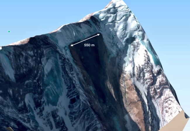
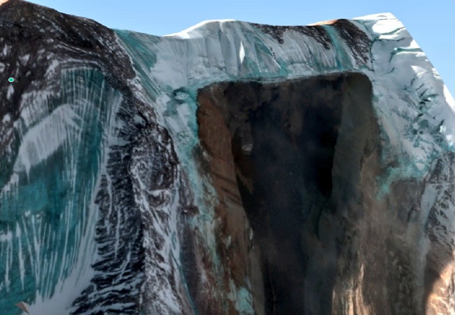
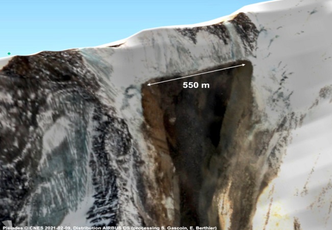
In another satellite images released by French Space Agency CNES, a 550 metre ‘deep cut’ could be seen in the wake of glacier breakage from Nanda Ghunti peak, at a prominence called Ronti peak.
These images were captured on Feb 9 and reveal a 550-meter long rupture line.
Scientists at French Space Agency CNES concluded that a massive rockslope failure released rock & ice that created a devastating flood in the Rishiganga river valley.
Satellite imagery before/after the flood points to widespread snow melt in only 5 days as per Simon Gascoin.