


-
- Published: June 24, 2020 15:43
New Delhi: A week after the bloody clashes at the Galwan valley, top level military talks led by Lt Generals took place between India and China on June 23, aimed at de-escalation and disengagement at the Line of Control (LAC).
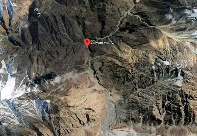
Similar meet took place at June 6, when both sides had agreed to disengage and de-escalate and pull back from the LAC by few kilometers. But, the Chinese side resorted to its treacherous designs and ambushed Army jawans at Patrol Point 14 in the Galwan valley. Though Chinese were taught a strong lesson by Bihar regiment of the Indian Army, the incident exposed the Dragon’s dubious face.
There has been ample proof of Chinese aggression at the LAC and its wicked designs to usurp Indian territory. Days after Galwan face-off, satellite imagery exposed China by showing how it mobilised forces, lined up armoured vehicles on its side of the LAC, clearly hinting at its intention.
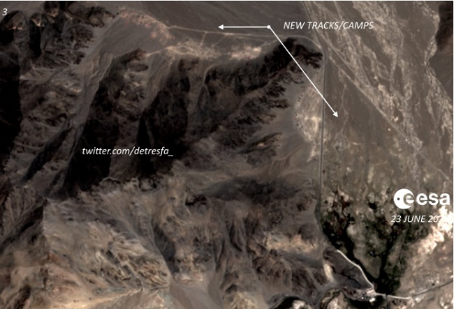
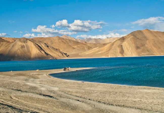
Now, a week later, it’s yet another nefarious design is under scrutiny, this time the point of contention is Pangong Tso lake.
Satellite images show China raising structures, PLA build-up
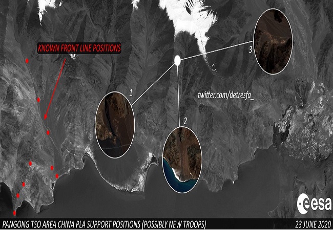
Latest Satellite images suggest that there is large and aggressive Chinese movement near Pangong Tso lake on the other side of LAC. It shows that Chinese PLA troops are building support positions here. Unlike Galwan valley, where they erected tents, here they are making permanent structures, satellite pictures show.
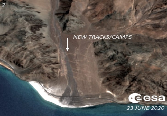
This region is apparently 19 kilometres from the area where Indian and Chinese soldiers engaged in bloody clashes. Though, the presence of tanks and armoured vehicles can’t be confirmed but this is certainly an attempt by the Chinese forces to alter the status quo of land border between the two nations.
Pangong lake & ‘Fingers’, at heart of India-China border dispute
The Line of Actual Control (LAC) doesn’t just run through land but also through the Pangong Tso — a 135 kilometre-long, narrow, deep and landlocked lake. The lake covers a total area above 700 square kilometres. The 45 km-long western portion is in Indian control.
In military parlance, the lake has several ‘fingers’. India claims Finger 8 to be its territory and Indian Army used to patrol upto this area but lately the Chinese troops have made incursions till Finger 4.
The People’s Liberation Army (PLA) has set up permanent bunkers, pillboxes and observation posts between Fingers 4 and 8. They have also built vehicle track from Finger 8 to Finger 4.
In the ongoing talks, Indian side is pushing for withdrawal of Chinese from this area but observers believe that getting them to pull down those structures and move back to original position till Finger 8 would be the toughest part of the disengagement process.